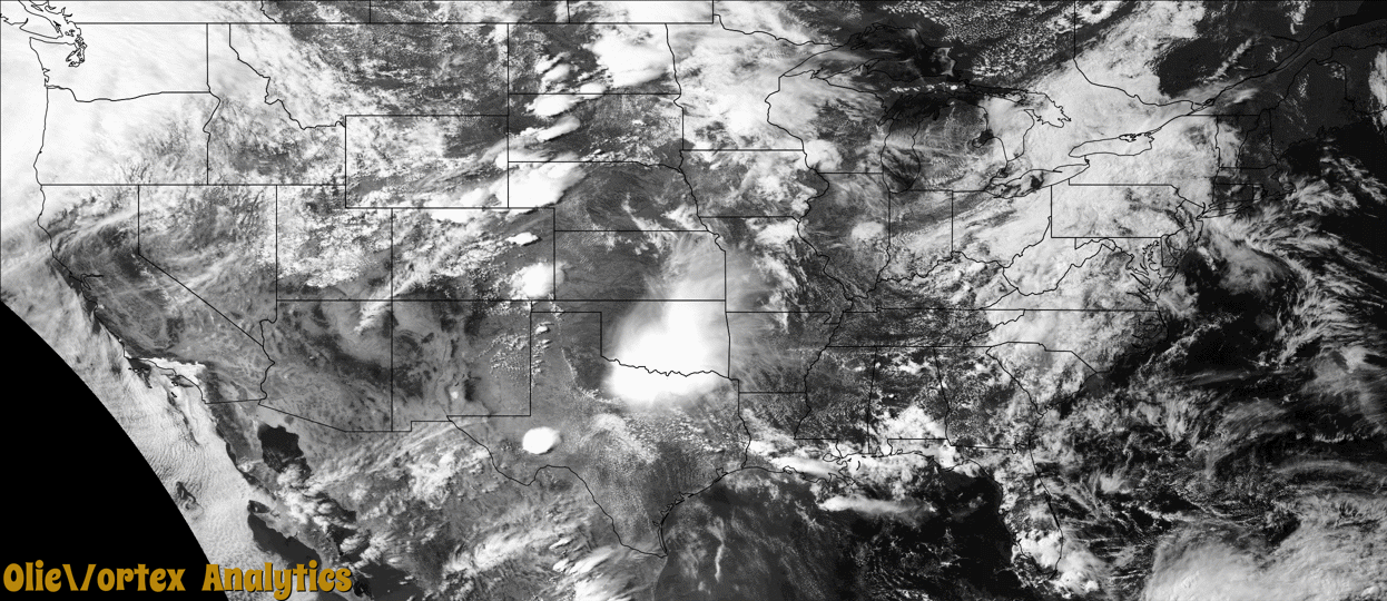
Tornado Reports
Sort by Time Sort by Rating Sort by State Sort by County| Time | Rating | Radar | State | County | Location | Narrative |
|---|---|---|---|---|---|---|
| 19:39Z | EFU | KBIS | ND | Logan | Burnstad | The tornado touched down in an open field north of Burnstad and impacted no structures. There was no damage to evaluate. By National Weather Service policy the tornado is rated EFU (Unknown). |
| 19:48Z | EFU | KBIS | ND | Stutsman | Woodworth | The tornado touched down in an open field south of Woodworth and impacted no structures. There was no damage to evaluate. By National Weather Service policy the tornado is rated EFU (Unknown). |
| 21:16Z | EF2 | KUDX | SD | Meade | Maurine | A tornado developed about 17 miles west of Faith, just north of Highway 212. As the tornado moved southeast and crossed Highway 212, numerous power poles were downed and broken. Some trees were also snapped off near the trunk and large branches broken off of other trees in this area. Additional trees were downed further southeast, before the tornado dissipated. The tornado did not impact any buildings or property along its path. The tornado traveled about 4 miles and was rated an EF-2, with wind speeds as high as 118 mph. |
| 23:18Z | EF0 | KMPX | MN | Renville | Sacred Heart | A storm chaser filmed a brief tornado. It broke a few large branches before moving into an open field and dissipating. |
| 00:11Z | EF0 | KAMA | TX | Hutchinson | Fritch | This tornado formed over Lake Meredith. The track of the tornado was parallel to the shoreline, before moving north-northeast into an inlet called Bugbee. The tornado then lifted as it approached the shoreline just south of Bugbee Cove. Numerous pictures confirmed tornado, and also produce some tree limb damage near the shoreline of Bugbee Cove. |
| 00:14Z | EF3 | KMAF | TX | Terrell | (p07)sanderson | Photos showed a tornado formed very near Sanderson along a ridge northwest of town. This tornado immediately entered a neighborhood west of US Highway 285 in Sanderson. Damage in this neighborhood included damage to walls and roofs of several houses with the complete destruction of a manufactured home. A sturdy steel carport collapsed in on itself, and trees were debarked in the area. This damage was rated with a max estimated wind speed of 140 MPH, making this tornado an EF-3. This tornado would continue a short distance to the east of this neighborhood, moving shipping containers and snapping power poles before lifting. Property damage cost is an estimation. Additionally, 12 injuries were reported, one was critical. |
| 00:16Z | EF0 | KAMA | TX | Hutchinson | Sanford | After thunderstorm moving back over land, a second tornado formed and moved northeast between Lake Meredith and the Bugbee community. A few mesquite tree limbs were snapped and other floral damage was indicated. |
| 00:20Z | EF1 | KMAF | TX | Terrell | (p07)sanderson | The same supercell thunderstorm that caused the first tornado would quickly produce another smaller tornado near the center of Sanderson a short time later. This tornado was photographed as a skinny rope tornado moving roughly parallel to Oak Street. This tornado would snap power poles, damage roofs, and destroy a small wooden building before lifting. This short-lived tornado was rated an EF-1 with peak winds estimated to have been 110 MPH. Property damage cost is an estimation. |
| 00:47Z | EFU | KABR | ND | Ransom | Ft Ransom | A trained storm spotter (DouglasB27) reported a tornado moving southeast towards highway 32 and had been on the ground 5 minutes prior to call. |
| 00:57Z | EFU | KAMA | TX | Briscoe | Silverton | Two tornadoes occurred simultaneously in northern Briscoe County. This is the location of the first tornado that was reported. Early on the evening of June second, a supercell thunderstorm developed in far northern Swisher County. The storm crossed an outflow boundary as it moved east across northern and eastern Swisher County resulting in increasing rotation and development of a low-level mesocyclone. Storm chasers reported a tornado as the storm crossed into western Briscoe County. As this tornado was dissipating by around 1910 CST, another tornado began developing on the western flank of the first, becoming the dominant tornado by roughly 1914 CST. For four to five minutes both tornadoes appeared to be in contact with the ground simultaneously. The second tornado remained over open terrain to the east of County Road 207 and Texas State Highway 86 before dissipating just east of the Caprock Escarpment to the northeast of Silverton by 1934 CST. |
| 01:10Z | EFU | KAMA | TX | Briscoe | Silverton | Two tornadoes occurred simultaneously in northern Briscoe County. This is the location of the second tornado that was reported. Early on the evening of June second, a supercell thunderstorm developed in far northern Swisher County. The storm crossed an outflow boundary as it moved east across northern and eastern Swisher County resulting in increasing rotation and development of a low-level mesocyclone. Storm chasers reported a tornado as the storm crossed into western Briscoe County. As this tornado was dissipating by around 1910 CST, another tornado began developing on the western flank of the first, becoming the dominant tornado by roughly 1914 CST. For four to five minutes both tornadoes appeared to be in contact with the ground simultaneously. The second tornado remained over open terrain to the east of County Road 207 and Texas State Highway 86 before dissipating just east of the Caprock Escarpment to the northeast of Silverton by 1934 CST. |
Storm reports are derived from "The Storm Events Database" (National Centers for Environmental Information) and/or "Past Storm Reports" (Storm Prediction Center).