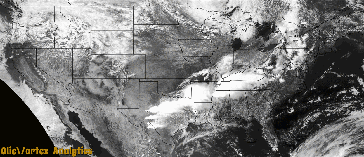
Tornado Reports
Sort by Time Sort by Rating Sort by State Sort by County| Time | Rating | Radar | State | County | Location | Narrative |
|---|---|---|---|---|---|---|
| 14:37Z | EF1 | KSRX | OK | Pittsburg | Quinton | This is the first segment of a two-segment tornado. This tornado developed west of Quinton, to the north of Highway 31. The tornado uprooted trees, snapped large tree limbs, and damaged the roofs of homes as it moved east across town, then moved into Haskell County near Highway 31. Based on this damage, maximum estimated wind in this segment of the tornado was 85 to 95 mph. |
| 14:42Z | EF0 | KSRX | OK | Haskell | Lewisville | This is the second segment of a two-segment tornado. The tornado moved into Haskell County near Highway 31. It moved east, and then east-northeast, dissipating north of Highway 31 and Highway 2, snapping numerous large tree limbs along its path. Based on this damage, maximum estimated wind in this segment of the tornado was 80 to 85 mph. |
| 20:29Z | EF3 | KSJT | TX | Sterling | Sterling City Cld Ar | A tornado touched down west of State Highway 163 at a ranch house|on Private Road 127. The tornado damaged the roof of the ranch|house as well as flipped over an RV trailer next to the house.|Between the ranch house and Highway 163, the tornado strengthened|destroying at least two utility poles, severely damaging trees as|well as turning over an oil pump jack. As the tornado approached|and crossed Highway 163, the tornado continued to intensify|damaging several utility poles along the highway and then moving|across a deer lease off Private Road 128, east of Highway 163. The|tornado completely stripped the rocks, the grass, the top soil, and|the caliche roads on the property. Only the stubs of the trunks of |the trees remained on the property. The estimated peak wind of|the tornado was 140 mph. |
| 23:21Z | EF2 | KGRK | TX | Bell | (tpl)temple Muni Arp | An EF-2 tornado formed near TX-317 between FM 2483 and W Adams Ave where at least a dozen power poles were significantly damaged. The tornado continued to move east/southeast across the Terrace at Lake Pointe subdivision damaging many homes, especially roofs and windows. Significant roof and tree damage was found in the neighborhood south of Tarver Elementary School. At least, four homes lost most of the roof, some outside walls, and sustained significant damage to the windows. Several trees were snapped or uprooted across the neighborhood. Then, the tornado crossed Tanglehead Dr. towards W. Adams Ave damaging many businesses, including stand-alone restaurants, shops, banks, and strip malls. A few of the businesses in this area lost most of their roof (DI 9, DODs 5 &7). Several cars sustained moderate to significant damage and cars were flipped. Most of the power poles were damaged or snapped along W. Adams Ave. The tornado continued to move southeast, crossing Old Waco Rd, damaging other homes and businesses (DI 2, DOD 6). Additional tree damage was found as the tornado tracked across an open field south of W. Adams Ave and west of S Kegley Rd. Maximum estimated winds were 120 mph. |
| 23:33Z | EF1 | KGRK | TX | Bell | Heidenheimer | A second tornado developed southeast of Temple near Bob White Rd north of FM-3117 tracking mostly over open field. Major roof damage was found near the intersection of these roads (DI 2, DOD 4). Additional but less extensive roof damage was seen to others homes as the tornado tracked southeast near Heidenheimer Rd. The team also found significant damage to several transmission lines along this area with more than a dozen towers flipped on its side. Many trees along the tornado track were also heavily damaged. Another home on Shaw Rd near Stallion Rd lost all its roof material and most of the wood beams constructing the roof. The tornado lifted soon after crossing Shaw Rd. This tornado was rated EF-1 with maximum estimated winds of 110 mph. |
| 00:30Z | EF1 | KSHV | LA | Bossier | Magenta | A slow moving supercell thunderstorm moving across southern Caddo and Bossier Parishes on the evening of May 22nd produced a very brief and relatively weak EF-1 tornado with estimated maximum winds near 97 mph in southern Bossier Parish on the north side of Highway 527 and just west of Red Chute Bayou. The tornado was most intense crossing over Cedar Street on the north side of Highway 527 where a carport was ripped off a single family residence, a metal building system had a door collapsed in, and an outbuilding had its roof blown off to the north. In addition, many trees were uprooted or had their trunks snapped in this general area. Other tree damage occurred elsewhere along the short path of the tornado with scattered signs of the typical convergent damage pattern consistent with tornadoes. |
Storm reports are derived from "The Storm Events Database" (National Centers for Environmental Information) and/or "Past Storm Reports" (Storm Prediction Center).