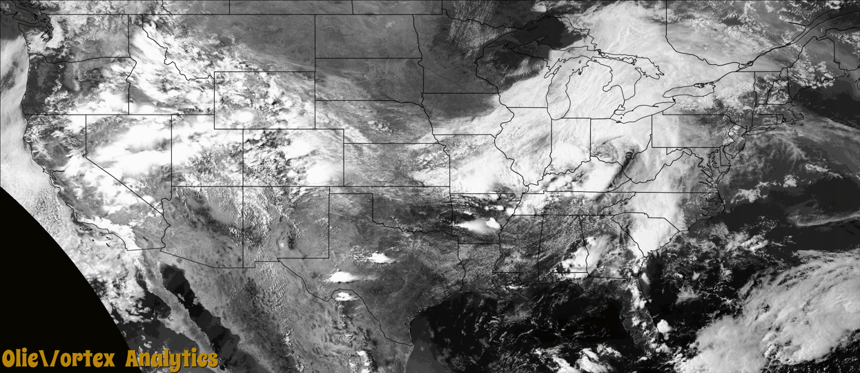
Tornado Reports
Sort by Time Sort by Rating Sort by State Sort by County| Time | Rating | Radar | State | County | Location | Narrative |
|---|---|---|---|---|---|---|
| 21:30Z | EF1 | KMRX | TN | Fentress | Jamestown Arpt | This EF-1 tornado touched down south of the Jamestown Municipal Airport near Highway 127 and traveled over 11 miles toward the east-northeast before lifting near Charley Hull Loop Road. The tornado uprooted and snapped hundreds of trees along the path. Over a dozen outbuildings and barns were completely destroyed, and several houses sustained roof and window damage. Local residents captured the tornado on video. High resolution satellite imagery was very helpful in determining the path of this tornado. No injuries or fatalities were reported. Damages are a rough estimate. |
| 21:59Z | EF1 | KHTX | TN | Cumberland | Dykes Xrds | This EF1 tornado touched down near Highway 70 about 3.6 miles northwest of downtown Crossville. A home on the south side of Highway 70 west of Ivey Road was destroyed when it slid off its foundation which it was not properly attached to, and a couple of outbuildings were destroyed on the north side of the highway. The tornado weakened as it moved northeast, but was widely visible and several local residents captured it on video. The tornado crossed Interstate 40 and caused minor damage to a hotel roof before lifting near Highway 127. No injuries or fatalities were reported. Damages are a rough estimate. |
| 22:04Z | EF1 | KMRX | TN | Scott | Black Creek | A NWS Storm Survey found an EF1 tornado outside of Helenwood, Tennessee. The tornado began on Grassy Knob Road and tracked to the northeast for approximately 3.40 miles in a non-continuous path. Numerous large trees were felled or snapped by the tornado, including several trees landing on and near mobile homes. Another tree fell on the rear portions of a car. A barn suffered minor roof damage to a carport attachment, with debris strewn downwind. |
| 22:58Z | EF1 | KMRX | TN | Fentress | Banner Spgs | This low end EF-1 tornado touched down west of the intersection of Bicknell Road and Leamon Hall Road and traveled toward the east-northeast before lifting west of Larue Lane. Dozens of trees were uprooted and snapped, causing damage to two homes and a few outbuildings. High resolution satellite imagery was very helpful in determining the path of this tornado. No injuries or fatalities were reported. Damages are a rough estimate. |
| 23:23Z | EF0 | KILN | OH | Miami | Ginghamsburg | The tornado first touched down on the west side of South Tipp-Cowlesville Road where a detached garage had part of its roof lifted and removed, with concentrated tree damage throughout the rest of the property. Some roofing material was carried across South Tipp-Cowlesville Road into adjacent fields, approximately 200 yards downstream. On the east side of South Tipp-Cowlesville Road, a grove of trees sustained some damage with large branches snapped and broken off. The tornado then continued northeast toward Tipp Canal Road, where it likely lifted on the west side of the road in an open field. Here, trees on the west side of the road in the distance clearly had been snapped and broken off near the top.||The damage was consistent with wind speeds of around 70 mph. |
| 23:35Z | EF0 | KILN | OH | Champaign | Christiansburg | The first damage was noted along South Lincoln Street where a few limbs were downed. From there, as the tornado slightly increased in intensity, the tree damage became more extensive along both North Lincoln Street and North Monroe Street between Pike Street and East 4th Street. Here, numerous large limbs were snapped off with most trees along these streets experiencing some damage. As the tornado exited Christiansburg on the north side of town along South Elm Tree Road, tree damage became less concentrated, but large limbs were still downed, especially along the west side of South Elm Tree Road. The tornado likely lifted in an open field between South Elm Tree Road and North Bollinger Road.||Damage along the tornado path suggested a maximum wind speed estimated at 75 mph. |
| 02:34Z | EF1 | KGWX | MS | Chickasaw | Pyland | This short-lived tornado initially touched down in a field just to the northwest of a mobile home on County Road 416, where a couple of trees were uprooted. The tornado then proceeded to damage a single-wide mobile home. The mobile home sustained significant roof removal and one of its walls partially collapsed. Additionally, the mobile home slid off of its foundation blocks and an attached patio partially collapsed. The tornado then traveled south-southeast across County Road 416 scattering debris from the mobile home into nearby trees and snapping several pine trees along the roadway. An adjacent single-story home received minor roof damage and partial uplift of its front porch along with a tossed carport. The tornado then traveled through a field and partially removed a metal roof from an outbuilding at a single-family residence before lifting. |
| 05:35Z | EFU | KDYX | TX | Jones | New Hope | Law Enforcement called stating that a Deputy south of Stamford reported a possible tornado which was rain wrapped and heading toward Avoca. |
Storm reports are derived from "The Storm Events Database" (National Centers for Environmental Information) and/or "Past Storm Reports" (Storm Prediction Center).