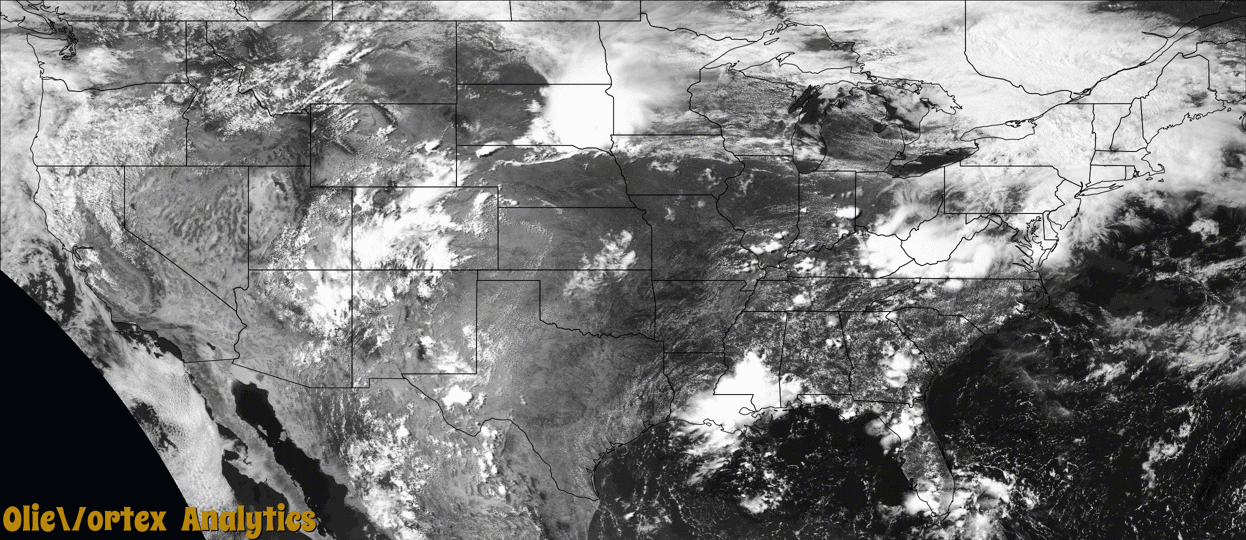
Tornado Reports
Sort by Time Sort by Rating Sort by State Sort by County| Time | Rating | Radar | State | County | Location | Narrative |
|---|---|---|---|---|---|---|
| 19:55Z | EF0 | KAKQ | VA | Lancaster | Monaskon | A weak tornado first developed over the Rappahannock River near Water View and then tracked southeast between Ottoman and Senora in Lancaster county causing minor damage to mainly trees and a few structures as it crossed River Road. The tornado continued southeast crossing the Corrotoman River before crossing the south end of Weems. More minor damage occurred in south Weems. The tornado then moved into the Rappahannock River where it later dissipated. |
| 20:05Z | EF1 | KFCX | VA | Grayson | Baywood | The tornado touched down in the Baywood community near the |intersection of Cross Roads Drive and Old Baywood Road where it |snapped a mature hardwood tree mid-trunk. A swirling pattern was |also noted in a nearby grass field. The tornado proceeded |southeast while intermittently snapping or uprooting multiple |hardwood and softwood trees along Greenwich and Delhart Roads. |The tornado then weakened and dissipated just to the southeast |of Delhart Road. |
| 21:31Z | EF1 | KLWX | MD | Prince George's | Collington | A supercell thunderstorm spawned a brief EF1 tornado just north of Bowie, MD in Prince Georges County late on Tuesday afternoon July 5th, 2022, between 5:31 and 5:34 PM EDT. This supercell spawned along the Howard/Montgomery County line as a result of a remnant mesoscale convective vortex moving through the region which had moved through the Ohio Valley earlier in the day. It evolved into a cluster of cells initially before splitting off into an individual supercell that would develop rotation as it moved out of southeastern Montgomery County into northwestern Prince Georges County. The tornado caused extensive tree damage in the Somerset subdivision just north of Bowie, MD. There was also one instance where a tree had fallen on top of a residence near the intersection of Stafford Lane near Saber Lane. However, there were several other trees down in the area outside of the more concentrated tornadic damage, particularly along Buckingham Drive perpendicular to White Marsh Branch. At this location along Buckingham Drive, trees fell upon power lines, snapping several supporting utility poles. The tornado initially touched down around Tarragon Lane and tracked eastward over the Bowie High School Annex before tracking into the Somerset subdivision, where the majority of the damage was observed. The tornado would then lift just before reaching southern portions of Whitemarsh Park. |
| 21:55Z | EFU | KLWX | MD | Anne Arundel | South River | A supercell thunderstorm spawned a brief tornado just north of Harwood, Maryland (4 miles southwest of Londontowne) in Anne Arundel County late Tuesday afternoon July 5th, 2022, between 5:55 and 5:56 PM EDT. This supercell originally developed along the Howard/Montgomery County line as a result of a remnant mesoscale convective vortex (MCV) moving through the region which had moved through the Ohio Valley earlier in the day. It evolved into a cluster of cells initially before splitting off into an individual supercell that would develop rotation as it moved out of southeastern Montgomery County into northwestern Prince Georges County. The cell dropped a tornado earlier in the afternoon near Bowie, and would then cycle to produce the second tornado in Harwood. A broadcast media partner provided video and eyewitness evidence of a brief spin-up tornado while located at the intersection of Birdsville Road and MD-2 Solomons Island Road. This individual noted that the tornado was located just to their north in an open field and was on the ground for about one minute. |
| 22:37Z | EF0 | KFSD | IA | Emmet | Estherville | This tornado was reported by local law enforcement with portions of it also captured on video. Some of the path was also evident in high resolution satellite imagery. This tornado remained mostly in open cropland doing damage to corn and beans. However, it did pass by a couple of farmsteads with EF0 damage to trees. |
| 01:44Z | EFU | KARX | IA | Buchanan | Fairbank | Emergency Management reported a brief tornado in an open field, just east of Fairbank. There was no observed damage to assign an EF-scale rating. |
| 02:00Z | EFU | KDVN | IA | Buchanan | Winthrop | Video from a Winthrop Fire Department Spotter captured a brief tornado just west of Winthrop. The tornado occurred in open farm land, and there was no observable damage to assign an EF-scale rating. Time estimated by radar. Assistance from Buchanan County Emergency Management is greatly appreciated. |
Storm reports are derived from "The Storm Events Database" (National Centers for Environmental Information) and/or "Past Storm Reports" (Storm Prediction Center).