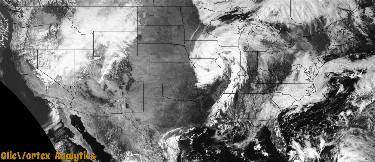
Tornado Reports
Sort by Time Sort by Rating Sort by State Sort by County| Time | Rating | Radar | State | County | Location | Narrative |
|---|---|---|---|---|---|---|
| 19:37Z | EF2 | KLSX | IL | Greene | Wrights | High resolution satellite data and information from storm spotters indicates the tornado touched down in an open field a little less than a mile south-southwest of the Berdan Road and Wrights Road intersection. The tornado moved north-northeast and intensified as it moved into the west side of the town of Wrights, IL. In Wrights, the tornado destroyed two new, well-built farm buildings, ripping one of from a concrete foundation around the perimeter of the building. The tornado then moved to the northeast, destroying two more farm buildings before crossing Wrights road, where it snapped a number of trees and rolled a camper onto a boat. The tornado continued to the northeast causing intermittent damage to trees and vegetation. The high resolution satellite data showed a prominent track in the open fields northeast of the NE 850 Ave and Super Slab Road Intersection. The last identifiable damage and where the tornado appeared to have ended is around a third of a mile west of the NE 1000 Street and NE 950 Ave Intersection. The tornado was rated EF2 with max wind speed of 115 mph. The path length was 5.83 miles with a max path width of 75 yards. No deaths or injuries were reported. |
| 20:26Z | EF0 | KILX | IL | Morgan | Alexander | A tornado touched down in an open field 0.5 miles northwest of Alexander at 3:26 PM CDT. The tornado tracked northeastward damaging several large trees before crossing I-72 near mile marker 76, where it blew over a semi truck. It continued northeastward damaging additional large trees before dissipating about 2 miles northwest of Alexander near Highway 123 at 3:28 PM CDT. |
| 21:28Z | EFU | KILX | IL | Woodford | Roanoke | A tornado touched down in an open field about 3 miles north of Roanoke at 4:28 PM CDT. It tracked northeastward for about 0.3 miles before quickly dissipating at 4:30 PM CDT. No damage was observed. |
| 21:45Z | EF0 | KILX | IL | Woodford | Washburn | A tornado touched down about 3.4 miles east-southeast of Washburn along County Highway 2100 North at 4:45 PM CDT. The tornado damaged the roof and walls of a barn and a couple large trees, throwing the debris into a corn field to the northeast. It continued tracking through fields before damaging an outbuilding along County Highway 2300 North. The tornado dissipated 3.5 miles east of Washburn at 4:51 PM CDT. |
| 22:10Z | EF0 | KLOT | IL | Will | Eagle Lake | A tornado with peak winds of 80 mph touched down just west of the Illinois Indiana state line near Red Oak Lane. The tornado produced minor tree damage before crossing into Indiana near the intersection of Bemes Road and State Line Road. |
| 22:11Z | EF0 | KLOT | IN | Lake | Kreitzburg | A tornado with peak winds of 80 mph touched down in far eastern Will County in eastern Illinois and crossed into Lake County in northwest Indiana near the intersection of Bemes Road and State Line Road. A farm outbuilding suffered minor damage just northeast of this intersection. The tornado crossed 113th Avenue and damaged fencing and soccer goals at the Illiana Christian High School. The tornado lifted near the intersection of 109th Avenue and Calumet Avenue. |
| 22:39Z | EFU | KILX | IL | Woodford | El Paso | A tornado touched down in an open field about 2 miles southwest of El Paso at 5:39 PM CDT. The tornado tracked northward across Highway 24 just west of El Paso before dissipating in a field 1.5 miles west-northwest of El Paso at 5:44 PM CDT. No damage was observed. |
| 22:47Z | EFU | KILX | IL | Putnam | Florid | A storm chaser reported a brief tornado. There was no visible damage to assign an EF-scale rating. |
| 23:30Z | EFU | KLOT | IL | La Salle | Triumph | A trained spotter reported a brief tornado touched down southwest of Triumph. No damage was reported. |
Storm reports are derived from "The Storm Events Database" (National Centers for Environmental Information) and/or "Past Storm Reports" (Storm Prediction Center).