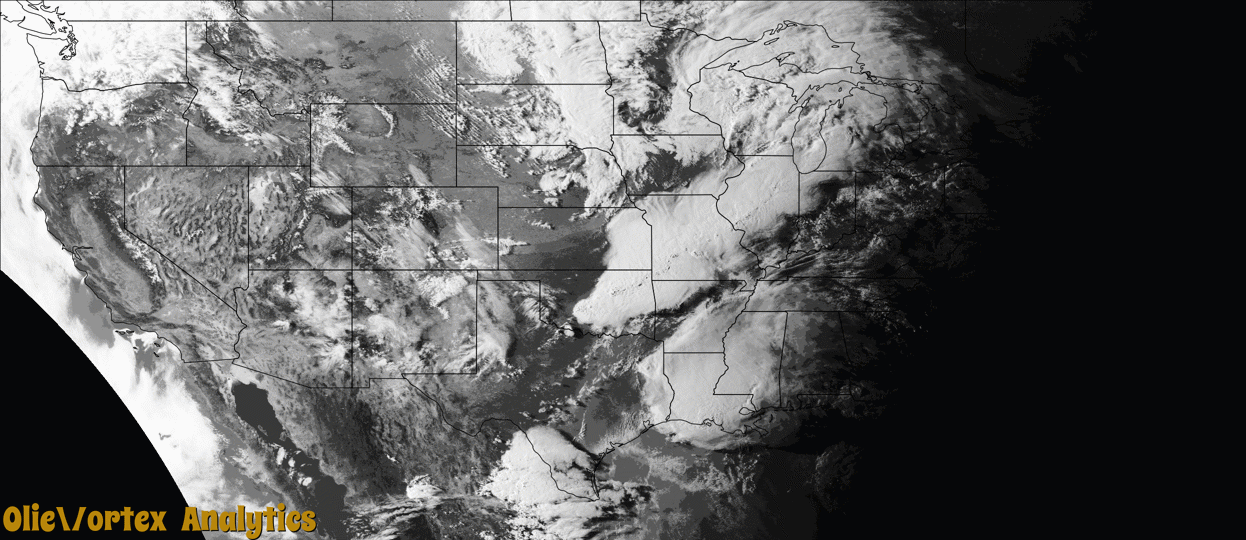
Tornado Reports
Sort by Time Sort by Rating Sort by State Sort by County| Time | Rating | Radar | State | County | Location | Narrative |
|---|---|---|---|---|---|---|
| 23:56Z | EF0 | KILX | IL | Sangamon | Dawson | A tornado touched down 1.8 miles west-northwest of Dawson at 6:56 PM CDT. The tornado tracked east-southeast across the south side of Dawson...damaging shingles, siding, and guttering on 12 homes before dissipating 0.3 miles east-southeast of Dawson at 7:01 PM CDT. |
| 02:02Z | EF1 | KSRX | OK | Pushmataha | Sardis | This tornado developed over the hilly terrain south of Sardis Lake. It uprooted trees and blew down power poles as it crossed the E 1660 Road, and then Highway 43, south of the lake. The tornado moved across the eastern portion of the lake, and came back onto land near the E 1625 Road, where trees were uprooted and large tree limbs were snapped. The tornado crossed Highway 2, where trees were uprooted, and then dissipated just south of the Latimer County line. Based on this damage, maximum estimated wind in the tornado was 90 to 100 mph. |
| 03:05Z | EF1 | KSRX | OK | Mccurtain | Sherwood | An EF-1 tornado with estimated maximum winds near 110 mph touched down along Johnny Beavers Trail Road, snapping and uprooting numerous trees. Several RVs and vehicles were significantly damaged by the snapped and uprooted trees. The tornado then crossed the Northern sections of Broken Bow Lake, snapping and uprooting several more trees before lifting along the eastern shore of the lake. |
| 03:20Z | EF2 | KSRX | OK | Mccurtain | Hochatown | An EF-2 tornado with estimated maximum winds near 125 mph touched down in a heavily wooded area along Union Valley Road, snapping and uprooting numerous trees. The tornado moved south southeast, tossing two barges over 100 yards and lifting a large portion of the roof deck of a home, causing it to collapse. The tornado then completely destroyed a single-wide manufactured home, with the base frame of the home twisted and tossed 100 yards to the east. Further to the south, another home sustained significant roof and structural damage when large gas tanks were tossed into it. The tornado then continued to snap numerous trees along Cascade Creek Road and along Wyr 20000 Road, as well as removing roofing material from another home on Union Valley Road. The tornado continued to track southeast across a heavily wooded area before crossing into Sevier County Arkansas. |
| 03:24Z | EF2 | KSRX | AR | Sevier | Cheatham | This is the continuation of the Eastern McCurtain County EF-2 tornado. This tornado snapped and uprooted numerous trees along Kellum Road in Northwest Sevier County, and continued to touch down intermittently several times as it tracked southeast. It touched down again along Bellah Mine Road as it crossed DeQueen Lake, with additional trees snapped and uprooted along Story Creek Road and DeQueen Lake Road. Minor metal roof damage to a garage of a home also occurred in this area. The damage swath broadened as the tornado approached Highway 71, when it crossed Crosstrails Road, damaging the roofs of two chicken houses while uprooting and snapping numerous trees. The tornado continued on to cross Highway 71 where numerous trees were snapped, a single-wide mobile home was rolled and destroyed, and the roof of a farm building was partially damaged. The tornado snapped approximately ten more trees before lifting just south of Highway 71/371 several miles east of DeQueen just east of the intersection of Farm to Market Road. Although the tornado will be rated an EF-2 with estimated maximum winds near 125 mph, found in Eastern McCurtain County Oklahoma, the tornadic damage in North-central Sevier County was estimated to be EF-1, with estimated maximum winds up to 105 mph. The total tornado path length from Eastern McCurtain County Oklahoma into North-central Sevier County Arkansas was near 20 miles. |
Storm reports are derived from "The Storm Events Database" (National Centers for Environmental Information) and/or "Past Storm Reports" (Storm Prediction Center).