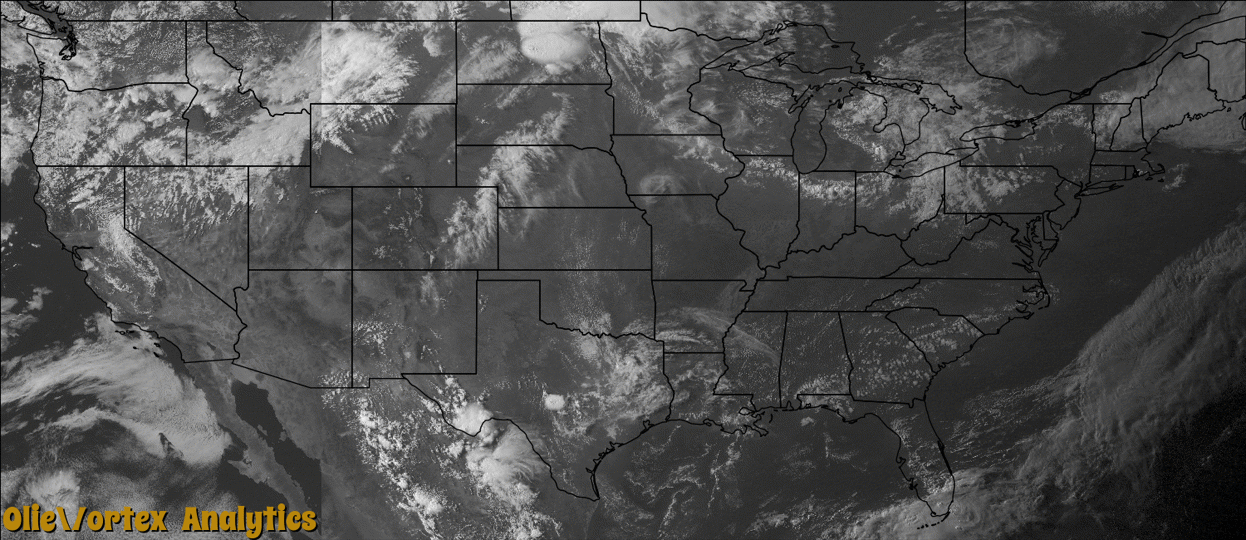
Tornado Reports
Sort by Time Sort by Rating Sort by State Sort by County| Time | Rating | Radar | State | County | Location | Narrative |
|---|---|---|---|---|---|---|
| 21:05Z | EF0 | KLOT | IL | Will | Beecher | A trained spotter sent video of a land spout on Route 1 near Beecher looking north. No damage was reported. |
| 23:09Z | EF0 | KMVX | ND | Cavalier | Wales | A tornado engulfed in downburst winds and hail tracked near Wales, snapping numerous tree limbs in shelterbelts along its path. Nearby fields were stripped of crops by wind driven hail. Peak winds were estimated at 85 mph. |
| 23:27Z | EF1 | KMVX | ND | Cavalier | Langdon | A weak tornado blew the doors off a seed company elevator and spread door and roof panels around the grounds in a circular pattern. Further downstream, the tornado snapped 6 power poles along 96th avenue northeast, a quarter mile east of highway 1. Peak winds were estimated at 105 mph. |
| 23:45Z | EF2 | KMVX | ND | Cavalier | Easby | This tornado was partially engulfed in downburst winds and hail along its nearly 20 mile path. Large wooden power poles were snapped, roofing was stripped off of homes, steel pole sheds were totally dismantled, numerous steel grain bins were crushed, and large metal segments were carried for a mile or more downwind. Bean and grain fields were completely stripped. Peak winds were estimated at 120 mph. |
| 00:08Z | EF2 | KMBX | ND | Benson | Knox | This tornado and corresponding rear flank downdraft wind produced widespread dust, which greatly reduced the visibility. Numerous ash, poplar, cottonwood, and evergreen trees were snapped or uprooted in shelterbelts and groves along its path. Peak winds of 119 mph were measured by a mobile system. |
| 00:12Z | EF1 | KMVX | ND | Pembina | Mountain | This tornado snapped trees in shelterbelts and demolished a pole shed at a farmstead. In addition, shingles and roofing materials were peeled from various buildings and a television antenna was bent over. Debris was spread downstream and over a wide arc to the north and northwest by the east-southeast moving storm. Peak winds were estimated at 110 mph. |
| 00:34Z | EF0 | KMBX | ND | Benson | Brinsmade | This tornado tracked largely over open country for about 2 miles, causing no significant damage. The ground swirl of the tornado was videoed by storm chasers near the west bay of Devils Lake, though very dusty conditions made visual detection difficult. Peak winds were estimated at 80 mph. |
| 01:27Z | EF0 | KMVX | ND | Ramsey | Keith | A brief touchdown was noted by an observer near Vining Oil, looking to the north. |
| 01:29Z | EF0 | KMVX | ND | Eddy | Hamar | This weak tornado crossed the southern end of Lake Washington, where a condensation plume was observed. Large branches were broken off of trees on either side of the lake, otherwise no significant damage was noted. Peak winds were estimated at 85 mph. |
| 02:32Z | EF0 | KMVX | ND | Griggs | Walum | A brief touchdown was reported southwest of Walum, by spotters northeast of Wimbledon and north of Dazey. A persistent wall cloud structure with funnel-like appendage was viewed for several minutes as it passed along the Barnes and Griggs county line. Though a brief dust swirl was detected, no significant damage was apparent. Peak winds were estimated at 70 mph. |
| 07:10Z | EF1 | KDLH | MN | Hubbard | Benedict | A weak tornado tracked to the northeast through a tree line and farmstead. The tornado snapped or uprooted numerous oak and pine trees, blew in part of a wall on a barn, and tore the roof off of a pole shed. Peak winds were estimated at 105 mph. |
Storm reports are derived from "The Storm Events Database" (National Centers for Environmental Information) and/or "Past Storm Reports" (Storm Prediction Center).