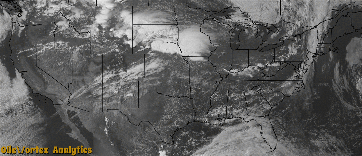
Tornado Reports
Sort by Time Sort by Rating Sort by State Sort by County| Time | Rating | Radar | State | County | Location | Narrative |
|---|---|---|---|---|---|---|
| 18:07Z | EF0 | KRIW | WY | Hot Springs | Dickie | A rancher north of Anchor Reservoir observed a brief tornado near Putney Flat in the Owl Creek drainage. The tornado remained over open country and did no damage. |
| 21:18Z | EF0 | KLNX | NE | Valley | Elyria | This tornado was witnessed by spotters in the area and maximum wind speeds were estimated at 85 mph. The tornado started in a grove of trees along the North Loup River. The tornado snapped a power pole and damaged a pivot as it traveled east southeast before lifting. A widespread area of sporadic wind damage extended south and east of the tornado, including across Fort Hartsuff State Historical Park. The buildings at the fort sustained no damage, but some trees on the property were damaged. At least one badly damaged tree was planted during the fort's active tenure of 1874 to 1881. |
| 22:01Z | EF0 | KUEX | NE | Greeley | Greeley | This brief tornado was witnessed by storm spotters, just east of U.S. Highway 281. This tornado contained a wind speed that was estimated at 70 mph. |
| 22:02Z | EF2 | KOAX | IA | Pottawattamie | Bentley | This short-lived tornado impacted a number of farmsteads as it tracked quickly to the southeast. The tornado downed trees, power lines, and completely destroyed outbuildings along its path. The tornado was embedded within a larger area of damaging winds associated with this intense supercell. |
| 01:20Z | EF0 | KGLD | KS | Kearny | Lake Mc Kinney | This was a brief ground circulation and funnel. |
| 03:30Z | EF3 | KTWX | KS | Nemaha | Bern | A tornado touched down around the intersection of highway 71 and 63 around 1030 pm CDT. The damage path moved southeast and included several homes that were severely damaged and one totally destroyed. The worst damage occurred to a slab home anchored to the foundation by anchor bolts installed with nuts and washers every 12-18 inches. All exterior and interior walls were destroyed however the debris was primarily laid on top of the slab with some debris blown to the south. Two adult residents took shelter in a tub and survived with minor injuries although the tub was gone and it was suspected to have been blown into a lake to the south. The tornado damage path continued southeast for approximately 6.5 to 7.5 miles total. EF3 rating with winds to around 140 mph. The end time of the tornado was around 1043 pm CDT. |
| 03:33Z | EF1 | KUEX | NE | Hamilton | Hampton | This tornado was not witnessed by anyone as it occurred after dark. A large area of damaging winds occurred northwest of where the tornado apparently formed. Tree damage, snapped power poles, and overturned pivots were common from just south of Marquette to southeast of Hampton. The most evident tornado damage was observed at two homes north of Hampton. Both homes lost part of their roof. One home was a manufactured home and the other was conventional construction. The southern of the two homes had parts of the roof blown back to the west and southwest, while the rest of the debris was strewn southeast along the storm path. Leaves and mud were plastered on the east side of both homes. Radar data did not show any obvious tornado-like signatures. Due to the widespread damage, it was difficult to identify exactly where the tornado began and ended. |
| 04:24Z | EF1 | KTWX | KS | Brown | Willis | A brief tornado touched down around 1124 pm CDT just east of Willis and moved to the southeast damaging two homes along a path lifting around 1 mile north of Everest at approximately 1130 pm CDT. Homes exhibited debris fields blown to the south and some debris was blown to the northwest. One home had 2 by 6 boards driven into the east side of the home. Rating was EF1 with winds to around 100 mph. |
| 10:25Z | EF0 | KLSX | IL | Jersey | Jerseyville | The tornado first touched down just south of Owl Branch Road west of the intersection with Cherry Lane. Several large tree branches were snapped off in this location and several tree tops were broken. The tornado travelled to the southeast. On the west side of Cherry Lane, a wall of a garage on the north side of the home was pushed in about 6 inches and some shingles were removed. Also, several large tree limbs were snapped off. The tornado crossed Cherry Lane and damaged a few more trees before lifting and dissipating. The tornado was rated EF0. It was on the ground for 1.44 miles and the max path width was 30 yards. |
Storm reports are derived from "The Storm Events Database" (National Centers for Environmental Information) and/or "Past Storm Reports" (Storm Prediction Center).