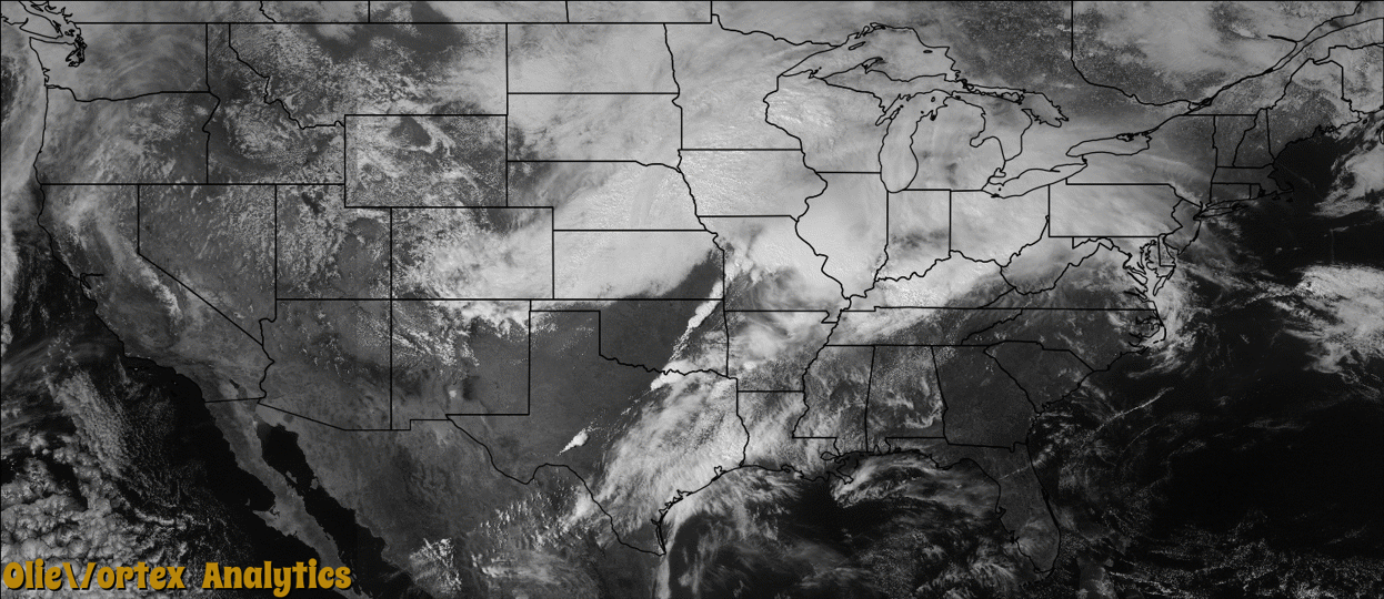
Tornado Reports
Sort by Time Sort by Rating Sort by State Sort by County| Time | Rating | Radar | State | County | Location | Narrative |
|---|---|---|---|---|---|---|
| 13:30Z | EF1 | KVWX | IL | White | Trumbull | At a home with an attached garage, the roof was lifted and partially separated from the walls. A large 42-by-66 foot machine shed with an attached lean-to was partially unroofed, and the doors were blown inward. Several small outbuildings were overturned. Approximately a dozen trees, mainly pine trees, were snapped or uprooted. Some debris was blown at least one-half mile away. The most intense damage occurred on County Road 1560N, northwest of Carmi. Peak winds were estimated near 100 mph. |
| 00:27Z | EF0 | KFWS | TX | Collin | Princeton | A National Weather Service storm survey crew determined a tornado caused EF0 damage to a subdivision in Princeton. The tornado produced damage to a number of homes, along with several fences which were blown down. |
| 00:56Z | EF0 | KNQA | MO | Butler | Stringtown | A double wide mobile home had about half of its roof blown off. A couple of trees and tree limbs were blown down. This weak tornado occurred on Missouri Highway M west of Poplar Bluff. Peak winds were estimated near 80 mph. |
| 01:03Z | EF1 | KFWS | TX | Hunt | Wagner | A National Weather Service storm survey crew determined a long track tornado produced EF1 damage in several spots in Hunt County. The hardest hit home was a ranch for exotic birds and chickens. This tornado produced a non continuous path for nearly 12 miles, producing several pockets of tree and fence damage. |
| 01:40Z | EF0 | KPAH | IL | Union | Kaolin | Two barns sustained partial loss of roof and wall metal panels. Two individuals witnessed the tornado. The tornado occurred along Route 146 near the intersection of Route 127. Peak winds were estimated near 75 mph. |
| 01:52Z | EF0 | KPAH | IL | Union | Western Saratoga | A storm damage survey conducted by National Weather Service meteorologists indicated mainly tree damage along the tornado path. There was loss of roofing material from an outbuilding. A few hardwood trees were uprooted. Branches were broken off. The tornado occurred on Shawnee National Forest property. Peak winds were estimated near 80 mph. |
| 02:00Z | EF0 | KPAH | IL | Union | Lick Creek | A National Weather Service damage survey indicated only tree damage along the tornado path, which ran parallel to and just northwest of Interstate 57. The tornado occurred in wooded areas of national forest property. Branches were broken. Hardwood trees were uprooted near the end of the damage path. Peak winds were estimated near 80 mph. |
| 02:00Z | EF1 | KPAH | MO | Butler | Fisk | The tornado formed near Fisk, right along the Stoddard County line. A very large hardwood tree over three feet in diameter was snapped. A couple of tree tops were down. The tornado was on the ground for just a short time in Butler County. Peak winds were estimated near 90 mph. The tornado crossed the St. Francis River into Stoddard County. |
| 02:01Z | EF1 | KPAH | MO | Stoddard | Dale | The tornado continued into Stoddard County from Butler County. Hardwood trees were uprooted or snapped. Branches were blown down. One small shed had partial loss of metal roofing and siding. Damage was intermittent along the track, which was over sparsely populated farmland. Peak winds were estimated near 95 mph. |
| 02:20Z | EF0 | KFWS | TX | Hopkins | Cold Ran | A National Weather Service damage survey crew determined a tornado produced EF1 damage in northern Hopkins County, near the city of Birthright. This tornado caused damage to several homes and businesses, including the Birthright Volunteer Fire Department building. A total of 76 houses or businesses were damaged in this tornado. |
| 02:25Z | EF1 | KPAH | IL | Williamson | Pulleys Mill | Roofing from two barns was torn off. One hardwood tree was uprooted. Some branches were blown down. This small tornado occurred between Creal Springs and Lake of Egypt. Peak winds were estimated near 95 mph. |
| 02:40Z | EF2 | KNQA | MO | Ripley | Hill Top | Thousands of mature large oak and pine trees were snapped and uprooted. One small shed was destroyed, and one larger metal building was unroofed. Some power and communication lines were blown down. This tornado occurred over heavily forested areas of the Current River Valley between Highway 21 and the Current River. Peak winds were estimated near 120 mph. |
Storm reports are derived from "The Storm Events Database" (National Centers for Environmental Information) and/or "Past Storm Reports" (Storm Prediction Center).