Tornado Reports
Sort by Time Sort by Rating Sort by State Sort by County| Time | Rating | Radar | State | County | Location | Narrative |
|---|---|---|---|---|---|---|
| 19:45Z | EF0 | KPUX | CO | El Paso | Ft Carson | A tornado occurred west of Highway 115 in a field. There was no damage. |
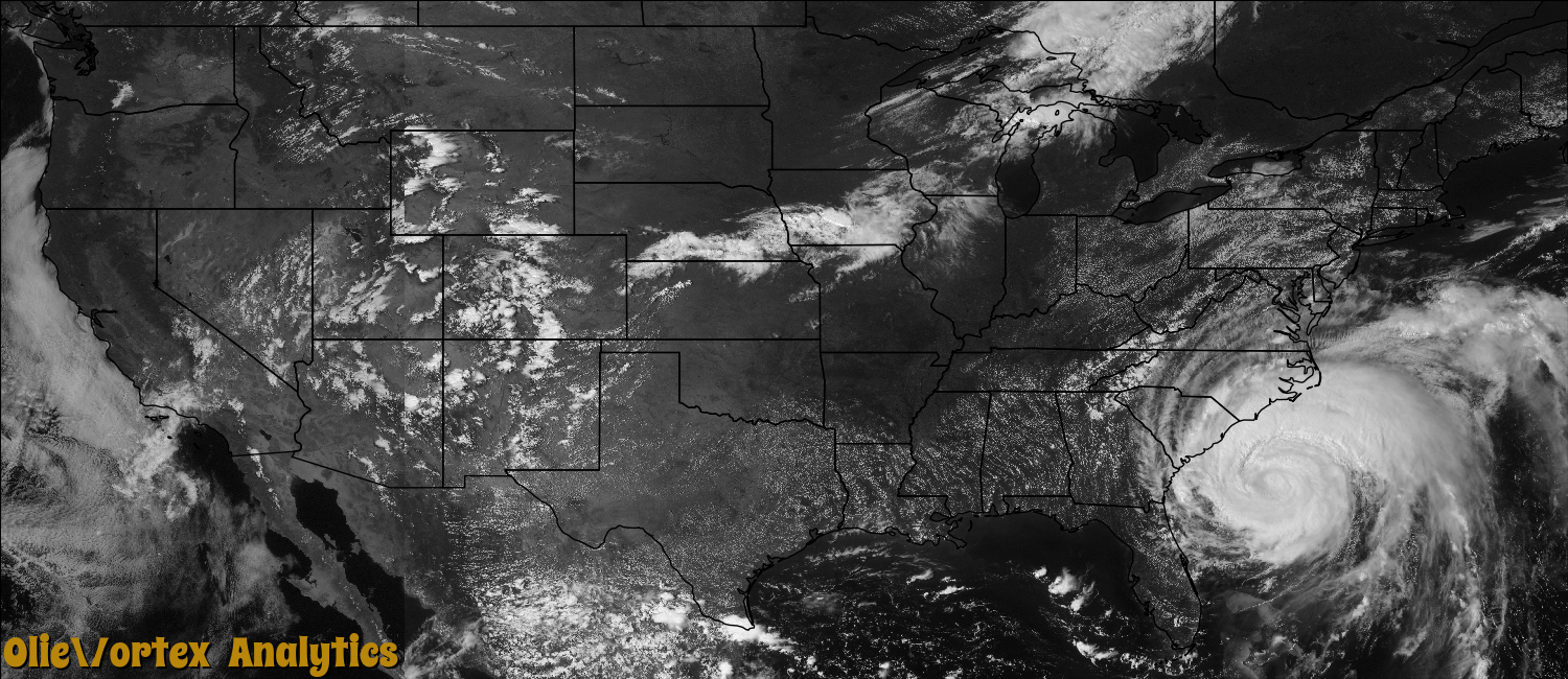
| 01:12Z | EF1 | KMHX | NC | Beaufort | Leechville | An EF1 Tornado touched down along Highway 264 and Bible Shore Rd. damaging large Pine trees. A utility trailer was also overturned. The tornado skipped 4.4 miles into Belhaven heavily damaging Edgewood Motors Dealership with two walls blown out. |
| 02:12Z | EF0 | KMHX | NC | Washington | Scuppernong | A brief EF1 tornado damaged a grain silo and a hardware store. |
| 03:55Z | EF2 | KMHX | NC | Tyrrell | Columbia | Several manufactured homes were completely destroyed with the metal undercarriages severely mangled and twisted around tree trunks indicating a high end EF2 tornado with estimated winds of 130 mph. |
Storm reports are derived from "The Storm Events Database" (National Centers for Environmental Information) and/or "Past Storm Reports" (Storm Prediction Center).