Tornado Reports
Sort by Time Sort by Rating Sort by State Sort by County| Time | Rating | Radar | State | County | Location | Narrative |
|---|---|---|---|---|---|---|
| 21:12Z | EF0 | KICT | OK | Osage | Burbank | A tornado snapped large tree limbs. A storm chaser witnessed this tornado. Maximum estimated wind in the tornado based on the damage was about 75 mph. |
| 21:42Z | EF0 | KTLX | OK | Lincoln | Stroud | Numerous sources (storm chasers, emergency managers, local media) reported a brief tornado that occurred over an open field. No damage was reported as a result of the tornado, although some minor damage occurred as as result of the RFD. The time was approximate. |
| 21:45Z | EF0 | KICT | KS | Saline | Glendale | Home took a glancing blow by a weak tornado. The tornado blew out the soffits and some shingles from both sides of the home. A shed on the back side of the property was blown about 25 feet to the northeast. Wrap around shingles and soffit material was found on the northwest and west quadrants of circulation and could not have been due to straight line winds. Home owner also saw small finger like funnel exiting property to the north. |
| 22:00Z | EF2 | KINX | OK | Osage | Hominy Arpt | A tornado damaged a metal building and a permanent home. It also snapped power poles and trees. Maximum estimated wind in the tornado based on this damage was about 115 mph. Several storm chasers witnessed this tornado. |
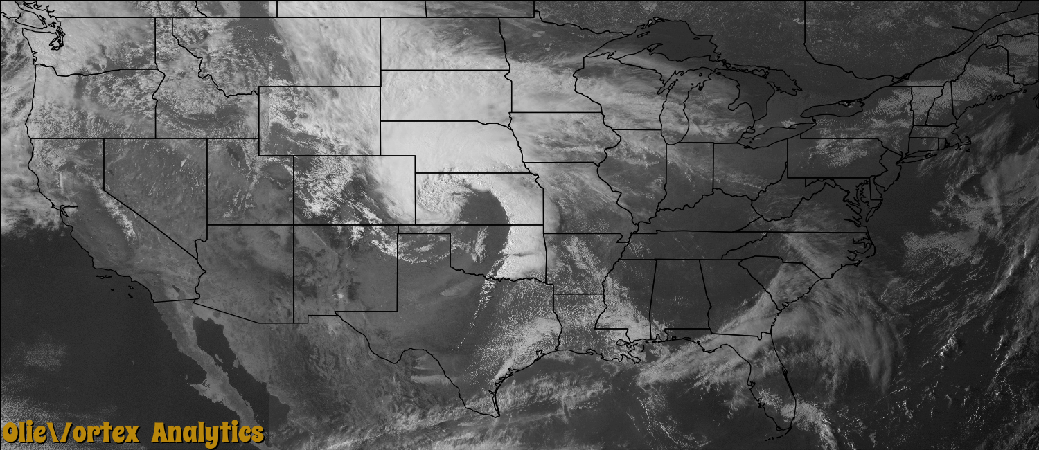
| 22:02Z | EF0 | KICT | KS | Cowley | Cambridge | Large tornado touched down in a very remote location and did not produce any damage. The tornado dissipated shortly thereafter. |
| 22:16Z | EF0 | KINX | KS | Chautauqua | Elgin | Tornado briefly touched down in open field. |
| 22:23Z | EF0 | KICT | KS | Saline | New Cambria | Thin rope like tornado touched down in an open field just to the east of town and moved to the north. |
| 22:24Z | EF1 | KTLX | OK | Pontotoc | Stonewall | Radar, storm chaser, and local medial reported a small tornado. The tornado was embedded in a larger area of thunderstorm wind damage associated with the rear-flank downdraft. A number of large trees were snapped. One tree fell on top of a car, damaging it. Monetary damages were estimated. |
| 22:38Z | EF0 | KTLX | OK | Okfuskee | Welty | A brief tornado developed over open country. The tornado resulted in no known damage. |
| 22:39Z | EF0 | KINX | OK | Washington | Ochelata | Storm chasers for KOTV witnessed a brief tornado over open country. The tornado resulted in no known damage. |
| 22:44Z | EF0 | KINX | OK | Washington | Ochelata | Spotters with Washington County Emergency Management witnessed a brief tornado over open country. The tornado resulted in no known damage. |
| 23:03Z | EF1 | KOUN | OK | Marshall | Madill | This tornado began three miles north-northwest of Madill and continued northeast into Johnston county. It finally lifted three miles south-southwest of Milburn. Damage was reported to several structures, with widespread tree/power pole/line damage. Monetary damages estimates were not available. |
| 23:05Z | EF1 | KINX | OK | Okfuskee | Haydenville | This is the first of two segments of this tornado. In this segment, the tornado snapped or uprooted several large trees. It was witnessed by storm chasers. Maximum estimated wind in the tornado based on the tree damage was 105 mph. The tornado continued into Okmulgee County, Oklahoma. |
| 23:11Z | EF0 | KICT | KS | Cowley | Cambridge | Tornado briefly touched down in a very remote area. Report via KAKE television. |
| 23:11Z | EF1 | KINX | OK | Washington | Dewey | This is the first of two segments of this tornado. In Washington County, this tornado uprooted several trees. Maximum estimated wind in the tornado based on this damage was 95 mph. The tornado continued into Nowata County, Oklahoma. |
| 23:12Z | EF1 | KINX | OK | Nowata | Glenoak | This is the second of two segments of this tornado. In Nowata County, the tornado damaged several permanent homes and snapped or uprooted trees. Maximum wind in the tornado based on this damage was about 105 mph. |
| 23:12Z | EF0 | KINX | OK | Okmulgee | Nuyaka | This is the second of two segments of this tornado. The tornado continued into Okmulgee County, producing no known damage in Okmulgee County as it remained over mostly open country until it dissipated. The rope stage of this tornado was recorded by storm chasers. |
| 23:12Z | EF0 | KTWX | KS | Clay | Broughton | A brief rope tornado was witnessed by the public who also attempted to catch the tornado with a photograph. The photo is looking east as a rain curtain wraps around the funnel and makes the funnel difficult to see. The witness stated that the tornado as described as a rope was only on the ground for a moment before lifting. No damage occurred. |
| 23:15Z | EF0 | KPDT | OR | Morrow | Lexington | EF0 tornado, which was spotted by a resident, caused damage to a pump house on the farm south southwest of Lexington. Insulation was seen twisting up in the air and 2x4s from the pump house landed 100 yards to the southeast. Pea sized hail was seen prior to the damage and thunder was heard 10 minutes prior to the damage. Trees, grass, and weeds were seen blowing in various directions. |
| 23:15Z | EF0 | KTLX | OK | Johnston | Tishomingo | This tornado was a continuation of the tornado that began 3 NNW of Madill in Marshall County. It continued to produce tree damage after crossing Lake Texoma into southern Marshall County. |
| 23:25Z | EF0 | KTLX | OK | Johnston | Milburn | Two off-duty NWS employees observed this tornado to the south of the tornado that moved from northeast of Madill to SSW of Milburn. No known damage occurred and the tornado location was estimated. |
| 23:33Z | EF0 | KTLX | OK | Okfuskee | Castle | KOCO storm chasers witnessed this brief tornado. The tornado resulted in no known damage. |
| 00:14Z | EF1 | KINX | OK | Pittsburg | Bond | A tornado snapped or uprooted a number of large trees. Maximum estimated wind in the tornado based on this damage was about 105 mph. |
| 00:20Z | EF3 | KTLX | OK | Atoka | Tushka | A large tornado began 5 miles west-southwest of Tushka and moved east-northeast through Tushka and about 3 miles southeast of Atoka before curving to the north-northeast and dissipating around 2 miles east of Stringtown. Almost 150 homes and business' were significantly damaged or destroyed, many numerous others sustaining minor damage. Two fatalities occurred in a mobile home to the west of Tushka. Monetary damage estimates were not available, although it is thought they would be well into the millions of dollars. |
| 00:21Z | EF1 | KTLX | OK | Atoka | Tushka | Another separate area of tree damage was noted north of the larger tornado that devastated Tushka. Monetary damages were estimated. |
| 00:47Z | EF2 | KINX | OK | Delaware | Eucha | A tornado destroyed a mobile home, injuring three people. Several other mobile homes were severely damaged. Trees were snapped or uprooted. Maximum estimated wind in the tornado based on this damage was about 125 mph. |
| 01:04Z | EF0 | KTLX | OK | Atoka | Redden | A tornado was observed by a storm chaser that developed south-southwest of Redden and moved east-northeast into Pushmataha County (see Storm Data for eastern Oklahoma for the Pushmataha County portion of this tornado.) This tornado produced no known damage. |
| 01:10Z | EF0 | KSRX | OK | Pushmataha | Jumbo | This is the second of two segments of this tornado, which developed in Atoka County, Oklahoma. A storm chaser witnessed a large cone-shaped tornado over open country. No known damage resulted from this tornado. |
| 01:12Z | EF0 | KSRX | OK | Pushmataha | Jumbo | A storm chaser observed a brief tornado northwest of Jumbo that was over open country. This tornado produced no known damage. |
| 01:12Z | EF1 | KSRX | OK | Pushmataha | Jumbo | A tornado snapped or uprooted a number of trees. Power poles were also snapped by this tornado. Maximum estimated wind in the tornado based on this damage was about 100 mph. This tornado was observed by a storm chaser. |
| 01:18Z | EF1 | KINX | OK | Wagoner | La Barge | A tornado damaged a permanent home, destroyed several outbuildings, and snapped or uprooted a number of trees. Maximum estimated wind in the tornado based on this damage was about 110 mph. |
| 01:28Z | EF1 | KSRX | OK | Latimer | Bengal | This is the first of two segments of this tornado. In Latimer County, this tornado damaged a home, severely damaged a barn, and snapped or uprooted a number of large trees. Maximum estimated wind in the tornado based on this damage was about 110 mph. The tornado continued into Le Flore County, Oklahoma. |
| 01:35Z | EF2 | KSRX | OK | Pushmataha | Crum Creek | A large tornado snapped or uprooted many large trees. Maximum estimated wind in the tornado based on this damage was about 115 mph. |
| 01:36Z | EF1 | KSRX | OK | Le Flore | Talihina | This is the second of two segments of this tornado. In Le Flore County, this tornado uprooted a number of trees. Maximum estimated wind in the tornado based on this damage was about 95 mph. |
| 01:36Z | EF1 | KTLX | OK | Atoka | Atoka | Another area of damage occurred south of the large tornado that devastated Tushka. This tornado damaged numerous trees and power lines. Monetary damages were estimated. |
| 01:46Z | EF1 | KSRX | OK | Atoka | Redden | An NWS storm survey found a barn destroyed and numerous large trees snapped or uprooted along a path from northeast of Redden to west-southwest of Daisy. Monetary damages were estimated. |
| 01:50Z | EF1 | KSRX | OK | Pushmataha | Sardis | A tornado blew down several trees. Maximum estimated wind based on this damage was about 90 mph. |
| 01:58Z | EF1 | KSRX | OK | Atoka | Daisy | This tornado developed to the south of Daisy in northeast Atoka County, then moved east-northeast into Pushmataha and Pittsburg Counties (see Storm Data for eastern Oklahoma for the Pushmataha and Pittsburg County segments of this tornado.) Numerous trees were snapped or uprooted, roof damage was observed to at least two homes, and a barn suffered severe damage. Monetary damages were estimated. |
| 01:59Z | EF1 | KSRX | OK | Atoka | Daisy | Numerous large trees were snapped and uprooted by a tornado that paralleled a larger tornado to the north. Monetary damages were estimated. |
| 02:03Z | EF1 | KSRX | OK | Pushmataha | Adel | This is the second of three segments of this tornado, which developed over northeastern Atoka County. In Pushmataha County, this large tornado snapped or uprooted many large trees. Maximum estimated wind based on this damage was about 105 mph. The tornado continued into Pittsburg County, Oklahoma. |
| 02:08Z | EF0 | KSRX | OK | Latimer | Yanush | A tornado that apparently developed over Sardis Lake uprooted a few trees and snapped numerous large tree limbs. Maximum estimated wind in the tornado based on this damage was about 85 mph. |
| 02:12Z | EF1 | KSRX | OK | Pittsburg | Weathers | This is the third of three segments of this tornado, which developed in northeastern Atoka County and moved across northwestern Pushmataha County. In Pittsburg County, this tornado snapped or uprooted a number of trees. Maximum estimated wind in the tornado based on this tree damage was about 105 mph. |
| 02:23Z | EF1 | KSRX | OK | Le Flore | Wister | A tornado rolled a mobile home, injuring three people, damaged the roof of a permanent home, and snapped or uprooted numerous large trees. Maximum estimated wind in the tornado based on this damage was about 105 mph. A storm spotter witnessed this tornado. |
| 02:35Z | EF1 | KSRX | OK | Le Flore | Howe | An anticyclonic tornado damaged a barn and snapped or uprooted trees. Maximum estimated wind in the tornado based on this damage was about 100 mph. |
| 03:10Z | EF1 | KSRX | AR | Sebastian | West Hartford | A tornado destroyed a large barn and uprooted trees. Maximum estimated wind in the tornado based on this damage was about 95 mph. |
| 03:33Z | EF0 | KSRX | OK | Mccurtain | Smithville | The National Weather Service conducted a storm survey in McCurtain County Oklahoma and found evidence of an EF0 tornado near Smithville. The tornado first touched down along US 259 southwest of Smithville where several trees were snapped on powerlines in front of a home. Some minor roof damage occurred to the home. The tornado crossed US 259 and snapped a few trees along the bank of Mountain Fork River. Near the end of the track���a large tree was snapped off along hwy 4 east of Smithville and several large branches were broken from trees in the area. Maximum winds are estimated at 65-70 mph. |
| 03:35Z | EF1 | KSRX | AR | Crawford | Dyer | A tornado damaged the roofs of two permanent homes, damaged a barn, and snapped or uprooted trees. Maximum estimated wind in the tornado based on this damage was about 100 mph. |
| 03:46Z | EF0 | KFWS | TX | Fannin | Honey Grove | A National Weather Service Storm Survey concluded an EF-0 tornado initially touched down about 1 mile northwest of Honey Grove near the intersection of County Road 2781 and Highway 82. The tornado moved to the northeast and lifted near the intersection of County Road 2875 and Private Road 287. Several structures and trees were damaged along the path. Estimated winds were 85 mph. |
| 04:02Z | EF0 | KSRX | OK | Mccurtain | Ringold | Numerous trees were uprooted and/or snapped. One barn was completely destroyed and one home had minor roof damage. The tornado was classified as an EF0 with a path width of 75 yards wide. |
| 04:07Z | EF1 | KSRX | AR | Polk | Mena | The tornado destroyed a warehouse used by a snack food company. Numerous trees were blown down, with one of the trees falling on a house. A barn was damaged. |
| 04:08Z | EF1 | KSRX | AR | Franklin | Charleston | A tornado rolled a trailer, damaged the roofs of two permanent homes, damaged two chicken houses, and snapped or uprooted a number of trees. Two people were injured in the trailer that was damaged. Maximum estimated wind in the tornado based on this damage was about 105 mph. |
| 04:12Z | EF1 | KSRX | AR | Yell | Gilkey | The tornado destroyed a barn and damaged two pieces of farming equipment. A number of trees were blown down. The damage path was entirely on private property, well away from any public roads. |
| 04:35Z | EF1 | KSRX | AR | Yell | Chickalah | A tornado destroyed a mobile home and blew down numerous trees. |
| 04:37Z | EF0 | KSRX | OK | Mccurtain | Hochatown | The National Weather Service conducted a storm survey in McCurtain County Oklahoma and found evidence of an EF0 tornado near Hochatown. The tornado first touched down along Meadow Lake Drive in Beaver Bend State Park. Several trees were uprooted while others had their tops ripped out. The tornado continued east crossing Coyote Drive uprooting a few trees in a camping area. The tornado finally lifted along the shoreline of Lake Broken Bow. Maximum winds are estimated at 65-70 mph. |
| 05:10Z | EF1 | KSRX | AR | Madison | Loy | A tornado damaged a home and uprooted trees. Maximum estimated wind in the tornado based on the damage was about 95 mph. |
| 06:13Z | EF1 | KLZK | AR | Garland | Ozark Lithia | Trees were blown down, with one landing on a barn. Roofs were blown off a barn and a shed. The tornado then moved into Hot Springs Village, where additional trees were blown down. One of these trees landed on a house. The tornado exited Garland County northwest of the incorporated portion of Fountain Lake and entered the Saline County portion of Hot Springs Village. |
| 06:15Z | EF1 | KLZK | AR | Saline | Hot Springs Village | This tornado exited Garland County northwest of the incorporated part of Fountain Lake and moved into Saline County in Hot Springs Village. In the Village, many trees were blown down and a number of these fell on houses. After leaving the Village, the tornado blew the porch off a house and damaged the roof, and blew down hundreds of trees. |
| 06:38Z | EF1 | KLZK | AR | Saline | Traskwood | Numerous large trees were uprooted or snapped. A barn was destroyed, and the barn's roof was thrown more than 100 yards. Several houses were missing shingles, and one of the houses was missing nearly 50% of its shingles. |
| 06:47Z | EF1 | KLZK | AR | Saline | Detonti | A house on U.S. Highway 167 had its roof and chimney damaged. Ironically, this same house had been damaged by a tornado 30 years ago. A mobile home had its roof and porch blown off. Numerous trees and power lines were blown down. Several houses suffered damage from falling trees. The roof of a country club was blown off, allowing water to pour inside and ruin a new wood floor that had just been installed. The tornado exited Saline County northeast of Lakeside and continued into Pulaski County west-northwest of Woodson. |
| 06:57Z | EF1 | KLZK | AR | Pulaski | Cammack Vlg | This tornado's track was entirely within the city limits of Little Rock. It touched down southwest of the intersection of W. Markham and John Barrow Rd. and ended in the Sherrill Heights neighborhood. While there was some shingle damage to houses, the vast majority of the damage was due to trees falling on houses and vehicles. The Leawood subdivision and The Heights were hard-hit. A Red Cross survey indicated two houses were destroyed, 36 suffered major damage, 49 had minor damage, and 37 others were affected. As of 7:00 AM CDT on the 15th, the Little Rock Police Department reported more than 40 streets blocked by fallen trees. A 34 year-old woman and her 7 year-old son were killed on Cynthia Dr. when a huge tree fell into the bedroom of their house. The root system of the tree was so large that it lifted a shed off the ground. On the same block, another huge tree was uprooted and the tree pulled natural gas lines out of the ground as it fell. |
| 07:01Z | EF1 | KLZK | AR | Pulaski | Ward | A tornado downed trees and power lines before tracking into an industrial park at the Port of Little Rock, where the worst damage occurred. A number of power poles were knocked down, one industrial building had damage to its walls, and another industrial building suffered roof damage. |
| 07:02Z | EF1 | KLZK | AR | Pulaski | Woodson | This tornado exited Saline County northeast of Lakeside and entered Pulaski County west-northwest of Woodson. In Pulaski County, many trees were blown down, with one of the trees falling on a house. Shingles were blown off a number of houses. |
| 07:09Z | EF1 | KLZK | AR | Pulaski | Rottaken | A tornado touched down near the Arkansas River levee and tracked through the Lands End Plantation. On the plantation, the trailer of a tractor-trailer truck was overturned, an old cotton gin was destroyed, and a 150 year-old pecan orchard was severely damaged. After leaving the plantation, numerous large trees were blown down and outbuildings were damaged. A mobile home was destroyed and its occupant was badly injured. Another mobile home was knocked off its foundation. A 250-gallon propane tank was ripped from its foundation and came unplugged. The tornado exited Pulaski County north-northeast of Wampoo and continued into Lonoke County west-southwest of Willow Belle. |
| 07:14Z | EF1 | KLZK | AR | Lonoke | Willow Belle | This tornado exited Pulaski County north-northeast of Wampoo and entered Lonoke County west-southwest of Willow Belle. In Lonoke County, most of the tornado's track was across open farm fields. A few trees were blown down. |
| 07:17Z | EF2 | KLZK | AR | Lonoke | Pettus | A tornado destroyed 51 large steel power transmission towers. These towers carried 500 kilovolt transmission lines. For the most part, the towers fell into open farm fields, but one fell into a pond on a fish farm. The power cables that fell with the towers blocked a number of roads, including Arkansas Highway 31. Power poles, power lines, and trees were blown down as well. |
| 11:26Z | EF0 | KDGX | MS | Issaquena | Mayersville | This tornado started just south of Hopewell Road, where it downed several trees and snapped large limbs in a treeline. As the tornado moved across Hopewell Road, it took a large amount of tin roofing off a mobile home, blew shingles off another home, and downed several trees. The tornado then snapped a few tree tops in a treeline just west of Grace Road as it dissipated. Maximum winds were 80 mph. |
Storm reports are derived from "The Storm Events Database" (National Centers for Environmental Information) and/or "Past Storm Reports" (Storm Prediction Center).