Tornado Reports
Sort by Time Sort by Rating Sort by State Sort by County| Time | Rating | Radar | State | County | Location | Narrative |
|---|---|---|---|---|---|---|
| 22:31Z | EF0 | KABR | SD | Walworth | Akaska | The first confirmed tornado touchdown was three miles south of Akaska. This was a brief touchdown with no damage reported. |
| 23:16Z | EF1 | KABR | SD | Walworth | Java | The second tornado touched down eight miles west of Bowdle or two miles south of Highway 12 near State Highway 47. The tornado knocked down six wooden power poles before it lifted. This is consistent with an EF1 rating with winds from 86 to 110 mph. |
| 23:21Z | EF2 | KABR | SD | Walworth | Java | The third tornado formed about four miles west of Bowdle on Highway 12. The tornado came down on a farm or formed immediately to the south of the farm. Several outbuildings were severely damaged with the residence sustaining siding and roof damage. A stock trailer was thrown about 75 yards from its initial point. Tree damage was sustained on the west side of the property with fallen trees leaning west. On the east side of the property, debris was scattered to the northeast. The damage on the farm was consistent with an EF2 rating with wind speeds ranging from 111 to 135 mph. The tornado continued moving northeast crossing into western Edmunds county where it intensified to an EF4. |
| 23:29Z | EF4 | KABR | SD | Edmunds | Bowdle | An EF2 tornado in eastern Walworth county crossed into western Edmunds county and intensified into a large EF4 tornado as it struck several farms in its path. At the first farm, several large cottonwood trees were uprooted along with damage to several trailers. Three grain bins were also destroyed with debris located several hundred yards to the northeast. The residence suffered some shingle and antenna damage. The tornado then tracked northeast to a second farm where several outbuildings were damaged or destroyed along with widespread tree damage. The main residence at this location suffered no damage. Several grain cars were also rolled about 100 yards into the trees behind the house.||The large tornado continued to track northeast to a third farm to the north of Bowdle. The main residence suffered major damage to walls with part of the roof structure removed. Widespread tree damage was sustained with many of the |trees completely debarked with only the stumps of the largest branches |remaining. Two large garages were completely destroyed with the |concrete slab wiped clean. The vehicles in one garage were |rolled or tossed from 25 to 100 yards away. It is estimated that one |vehicle flew through the air 75 to 100 yards resting in the tree |shelter belt to the north of the residence. Several other outbuildings were completely destroyed.||The tornado then toppled six to eight metal power transmission towers as it moved to the north of the farm. One tower was sheared off from the concrete footings and traveled an estimated 400 yards. Ground scouring was visible along the path of these towers.||The large tornado continued to track east crossing over State Highway 47 where a state radio tower was toppled. The tornado lifted shortly thereafter. The highest wind speeds were estimated to be from 166 to 200 mph. |
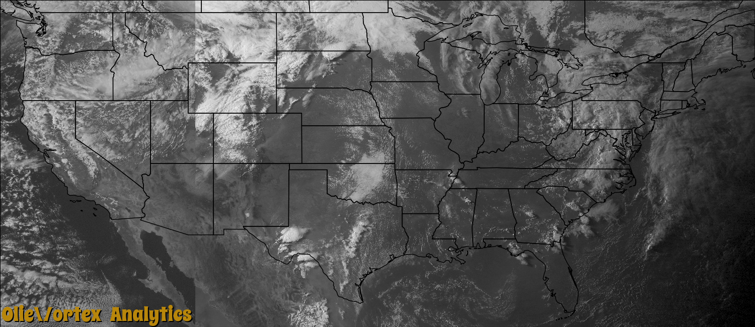
| 23:36Z | EF0 | KMAF | TX | Pecos | Chancellor | At 1536 CST, a tornado was confirmed by trained spotters about 22 miles west of Fort Stockton. The tornado then tracked south southeast for about 4 minutes, and was spotted by local law enforcement. It was determined by a damage survey, and several spotter reports, that the tornado dissipated around 1549 CST. Only minor damage was done to vegetation by this tornado. Please see the photos of the tornado taken by the spotters. |
| 00:10Z | EF0 | KABR | SD | Edmunds | Gretna | A fourth tornado touchdown occurred northwest of Roscoe or one-half mile north of the intersection of Highway 12 and State Highway 253. There was no damage reported with this brief touchdown. |
| 00:48Z | EF0 | KABR | SD | Edmunds | Beebe | A sixth satellite tornado was observed in conjunction with the main tornado. The tornado was brief and caused no damage. |
| 00:48Z | EF0 | KABR | SD | Edmunds | Beebe | A fifth tornado touchdown occurred seven miles northwest of Ipswich. The tornado lifted quickly with no damage reported. |
| 01:01Z | EF2 | KABR | SD | Edmunds | Ipswich Taylor Arpt | The seventh tornado formed in northeast Edmunds county and tracked northeast. The tornado took off sections from the roof of a barn. The tornado then tracked through primarily crop and pasture land to near Deerfield Colony and into southeast Mcpherson county. Sporadic tree damage was observed along the tornado path with many wooden power poles completely sheared off. Wind speeds with this tornado were estimated between 111 and 120 mph. |
| 01:12Z | EF2 | KABR | SD | Mcpherson | Long Lake Colony | A tornado entered southeast Mcpherson county from northeast Edmunds county. The tornado struck a farm along State Highway 45 where a calving shed was completely destroyed with large sections of the roof blown over 100 yards. The tornado then caused moderate damage to a barn with one collapsed wall. Multiple softwood and hardwood trees were uprooted and many power poles were completely snapped near the base. The tornado tore the roof off a turkey barn at the Long Lake Colony. Several Wetonka homes also sustained minor roof damage. The wind speeds were estimated between 111 and 120 mph. The tornado then moved into western Brown county and dissipated. |
| 01:15Z | EF0 | KMAF | TX | Pecos | Chancellor | A trained weather spotter reported a tornado at 1715 CST about 18 miles west southwest of Fort Stockton. No damage was reported with this weak brief touchdown. |
| 01:26Z | EF1 | KABR | SD | Hyde | Highmore Arpt | A tornado touched down for a short time in far northeast Hyde county hitting a farm. The tornado damaged or destroyed several large barns, eighteen grain bins, along with the garage on the home. A grain cart was also tipped over by the tornado along with twelve cattle being killed. |
| 01:34Z | EF0 | KABR | SD | Brown | Barnard | A tornado entered into western Brown county from southeast Mcpherson county. The tornado was an EF2 before entering Brown county. The tornado slowly dissipated shortly after entering the county with some tree damage observed. |
| 01:45Z | EF0 | KLNX | NE | Cherry | Sparks | At 845 PM CDT, the tornado touched down over an open field west of Sparks and traveled east where it struck a metal building tearing off the southwest facing roof. The tornado destroyed a portion of a grandstand and completely demolished a concession stand before lifting 200 yards east of the concession stand. |
| 02:10Z | EF2 | KABR | SD | Brown | Houghton | An eighth tornado touched down west of Hecla producing damage to one farm including tearing the roof off of an outbuilding and throwing several grain bins 100 yards or more. Widespread tree damage was also noted. The tornado continued northeast damaging another outbuilding and destroying an empty grain bin before lifting. Wind speeds were estimated between 112 and 120 mph. |
| 02:11Z | EF2 | KLNX | SD | Tripp | Winner | A tornado tracked along East 3rd Street in Winner, blowing down carports, trees, and tractor-trailers. A large barn was destroyed east of Winner; the curved roof was blown off in one piece and tossed across a corral. Another machine shed was blown apart. Based on the extent of the damage, wind speeds were estimated around 75 mph through town with peak winds 95 to 115 mph. |
| 02:30Z | EF2 | KLNX | NE | Keya Paha | Norden | At 930 PM CDT, a tornado touched down approximately 12 miles northwest of Springview and traveled northeast for 20 minutes before lifting 11 miles north of Springview. The tornado did extensive tree damage when it touched down, then moved northeast and struck two farmsteads. At the first farmstead, a loafing shed and stock trailer were destroyed, extensive tree and fence damage occurred, and a roof was torn off an old hog building. The most extensive damage occurred north of the farmstead where six rural electric association poles where broken. The tornado continued to move northeast and destroy a windmill. Then a second farmstead was hit with the tornado destroying a 40 by 60 feet quonset building before the tornado lifted at 950 PM CDT. |
Storm reports are derived from "The Storm Events Database" (National Centers for Environmental Information) and/or "Past Storm Reports" (Storm Prediction Center).